
Day 5 - Tuesday. The wrong trousers.
I woke up at 5:45 and as the sun was shining I went out with the camera, but it was a pale hazy light and not really worth photos so I went back to bed and dozed till seven, and then took some photos.

Breakfast was muesli followed by some food Id been given at Lochan nam Breac hot chocolate with bread rolls and jam. Very civilised. Thanks guys. At eight I was on my way up the stalkers path which zig-zags up the west side of Sgurr Beag. My plan was to keep travelling east along the ridge over Sgurr Beag, Sgurr Mor, Sgurr an Fhuarain, Gairich, and then drop down to a camp spot beside the river in the Kingie Forest.
I stopped at the col between Sgurr Beag and Sgurr Mor for a rest and a bite to eat, and then another good stalkers path climbed up Sgurr Mor. This was a bigger steeper hill than Sgurr Beag so the good path was appreciated.

At the top (10:30) I sat in the lee of the cairn snacking on nuts and looking at the fabulous view in all directions.

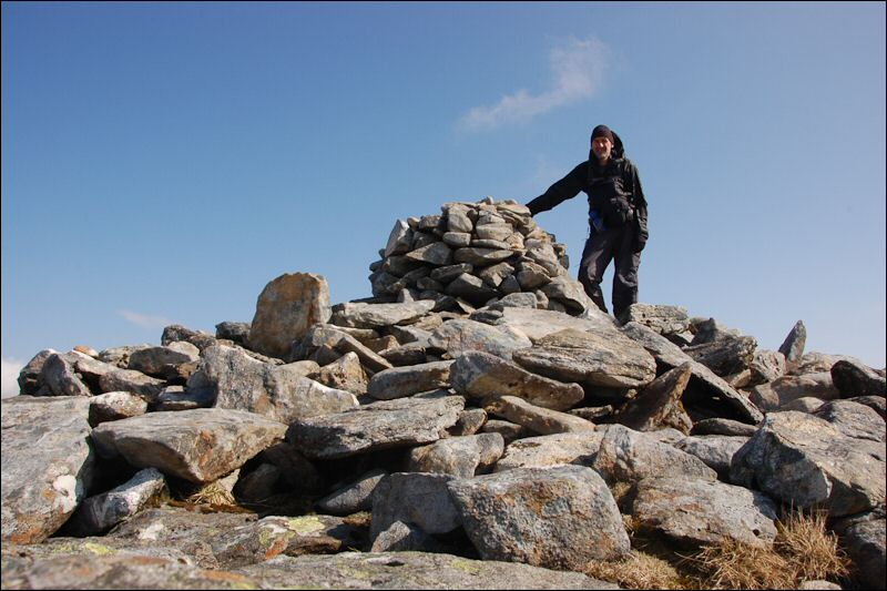
The ground had been slowly getting gentler and now the ridge onwards was a grassy sweep down and up to Sgurr an Fhuarain where I took a photo of myself beside the trig point. The backs of my hands were facing upwards on my Pacerpoles and getting burnt by the sun - hence the gloves. I'd also brought the wrong trousers for this heat, a pair of Paramo Cascadas which were both heavy and hot.

The ground now dropped away considerably to the lowest point (360m 1200) since Lochan nam Breach, and I stopped here for lunch at 1:30.

It was well after two when I set off again, and I had decided not to climb Gairich, the natural last peak of the ridge. It was now very hot, the hill was very steep, and I was very tired, so I took the easy option and set off down the track into Glen Kingie.
Lower down the glen the track entered a forest and I saw a pair of osprey.


My planned campsite was at NN 089993 where the map shows a track going down to the river. Id checked this area out on www.geograph.co.uk and it looked like there was probably a place to camp. Before I got quite that far I could see a very inviting camp spot beside the river below me, so I dropped down to the river bank, only to find that what looked like a nice level area running along beside the river had been sluiced by winter floods and was very stony and uneven. I followed the river round to my planned camp spot with no luck, always what looked good from a distance turned out to be too rough on closer inspection. Where the map shows the track coming down to the river there were a few remains of a long gone bridge, and the river was no more than a trickle here. The other bank looked more promising so I crossed over and found myself struggling through tussocks which was a bit annoying, but I persevered and eventually on the promontory 300m above the bridge at NN 089996 I found a good place to camp.

The river seemed to be a series of fast running shallows between still pools. The pools were so still that there was a film of some sort on the surface, and I had to go some distance downstream to get water. The evening was so hot I did think of having a swim in one of these pools, but the black bottomless depths didnt look inviting. I had the John West Tuna Steaks I had been given with cous-cous for dinner, followed by custard with rehydrated rhubarb (from the garden at home).
Day 06 Intro